Kerala government to implement Sabarimala airport project
AVIATION & AIRPORTS

Kerala government to implement Sabarimala airport project

Despite the queries raised by the Ministry of Civil Aviation (MoCA) on the planned airport project at Sabarimala, the government will execute the project.

The government began preparations for the site survey, and a drone survey of Cheruvally estate has been allotted for the project.

On September 8, a review meeting held by CM Pinarayi Vijayan had evaluated the project, reviewed its status and the measures that need to be taken promptly to expedite its execution.

Quoting the views of the director general of civil aviation (DGCA), the Ministry of civil aviation had asked for some clarifications from the government regarding the application for project approval. A decision was taken during the CM’s review to provide a reply in this regard. Ministry of defence approval is anticipated soon since the Indian Air Force (IAF) has conveyed that it has no problem giving site permission.

But, a social impact assessment study, soil test could not be conducted because of pending litigations on ownership of the designated land. Whatever MoCA stated in the letter quoting DGCA’s report is part of routine administrative communication. The letter itself shows that despite the guidelines on greenfield airports that the planned airport may not meet, the project still can be approved by the government.

The proposed site will need a considerable amount of preparatory work to make it suitable for the project. According to the environmental impact assessment report provided by the consultant Louis Berger Consulting Pvt Ltd, a preliminary analysis of the site topography shows that the current elevation ranges from 40 m to 170 m, while the current average mean elevation is about 112 m.

The observed site is challenging in terms of grading requirements since there is a vast difference between maximum and minimum elevation. The fundamental part of the project site is at a higher elevation, while the boundaries are at a lower elevation. Current topography comprises moderately-high to steep slopes in a considerable area of the project site.

The consultant told the media that it has been assessed that 130 structures and five common property resources will be affected (approximately), comprising a temple, a church, a mosque and a hospital. The airport, which is considered to have 800 passengers by 2029-30 and 1,850 passengers during peak hours by 2049-50, is likely to break even only in 60 years. It raises many questions about the economic viability of the project.

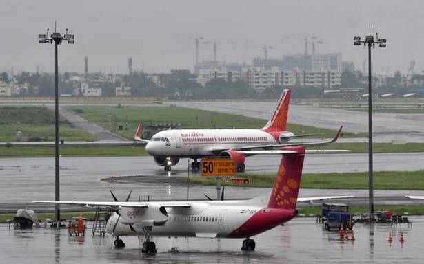
Image Source


Also read: DCGA issues Aerodrome license to IRB Sindhudurg Airport

Despite the queries raised by the Ministry of Civil Aviation (MoCA) on the planned airport project at Sabarimala, the government will execute the project. The government began preparations for the site survey, and a drone survey of Cheruvally estate has been allotted for the project. On September 8, a review meeting held by CM Pinarayi Vijayan had evaluated the project, reviewed its status and the measures that need to be taken promptly to expedite its execution. Quoting the views of the director general of civil aviation (DGCA), the Ministry of civil aviation had asked for some clarifications from the government regarding the application for project approval. A decision was taken during the CM’s review to provide a reply in this regard. Ministry of defence approval is anticipated soon since the Indian Air Force (IAF) has conveyed that it has no problem giving site permission. But, a social impact assessment study, soil test could not be conducted because of pending litigations on ownership of the designated land. Whatever MoCA stated in the letter quoting DGCA’s report is part of routine administrative communication. The letter itself shows that despite the guidelines on greenfield airports that the planned airport may not meet, the project still can be approved by the government. The proposed site will need a considerable amount of preparatory work to make it suitable for the project. According to the environmental impact assessment report provided by the consultant Louis Berger Consulting Pvt Ltd, a preliminary analysis of the site topography shows that the current elevation ranges from 40 m to 170 m, while the current average mean elevation is about 112 m. The observed site is challenging in terms of grading requirements since there is a vast difference between maximum and minimum elevation. The fundamental part of the project site is at a higher elevation, while the boundaries are at a lower elevation. Current topography comprises moderately-high to steep slopes in a considerable area of the project site. The consultant told the media that it has been assessed that 130 structures and five common property resources will be affected (approximately), comprising a temple, a church, a mosque and a hospital. The airport, which is considered to have 800 passengers by 2029-30 and 1,850 passengers during peak hours by 2049-50, is likely to break even only in 60 years. It raises many questions about the economic viability of the project. Image SourceAlso read: DCGA issues Aerodrome license to IRB Sindhudurg Airport

Next Story
Infrastructure Transport

Mumbai-Pune Expressway 'Missing Link' Nears Completion

The long-awaited "Missing Link" on the Mumbai-Pune Expressway is now 92% complete and is expected to open by August 2025. The 13.3-km stretch, developed by the Maharashtra State Road Development Corporation (MSRDC), will significantly improve connectivity between Khopoli and Kusgaon. This eight-lane access-controlled expressway bypasses the steep 19-km Khandala Ghat section, reducing the route by 5.7 km and cutting travel time by 20-30 minutes. The new alignment is designed to ease monsoon-induced congestion and minimize landslide risks. The project features two tunnels—1.75 km and 8.92 km..

Next Story
Infrastructure Transport

Gurugram Metro to Upgrade 335.52 km of Roads

In a significant move to enhance access to the upcoming Gurugram Metro, the Gurugram Metro Rail Ltd. (GMRL) has identified a total of 335.52 km of roads, lanes, and adjoining areas in need of improvement. This initiative, which is part of the metro project's broader goals, focuses on improving walkability and promoting non-motorised transport (NMT) around metro stations, benefiting daily commuters and residents. The infrastructure upgrades will include improvements to the carriageway, the development of green zones and swales, pedestrian paths, cycle paths, service roads, and the installation ..

Next Story
Infrastructure Transport

URC Constructions Wins Bid for Veerannapalya Metro Station

Bangalore Metro Rail Corporation Ltd. (BMRCL) has awarded the remaining construction contract for the Veerannapalya Station of the Blue Line to URC Constructions Pvt. Ltd. after the firm emerged as the lowest bidder. The bid, valued at Rs. 357.4 million, is for the completion of the elevated station under Phase 2B of the Bangalore Metro project. This project is part of the under-construction Blue Line of Bangalore Metro's Phase 2A (ORR Line) and Phase 2B (Airport Line), which will connect Silkboard, KR Puram, and Bengaluru International Airport through 30 stations. Initially, the constructio..

Advertisement

Advertisement

Subscribe to Our Newsletter

Get daily newsletters around different themes from Construction world.

STAY CONNECTED

Advertisement

Advertisement

Advertisement

Advertisement

Talk to us?