Lt governor launches GIS-based systems in J&K
Technology

Lt governor launches GIS-based systems in J&K

Lieutenant Governor Manoj Sinha this week launched the Jammu and Kashmir Remote Sensing Information System (JKRIS), a spatial data infrastructure initiative, and g-SAM (Gram Panchayat Spatial Assets Mapper) mobile app.

He said the Geographic Information System technology offers new communication tools to different sectors and makes great impact in areas like weather forecasting, urban and transport planning, security and biodiversity protection.

He also released reports on the assessment of inherent vulnerability of climate change and internal monitoring of Wular Lake and its catchment area.

Highlighting the significance of the GIS technology in addressing new challenges and exploring new opportunities, Sinha said the encouragement to spatial thinking, development of new GIS tools, and real-world applications are accelerating the growth in business, government and society.

“GIS is playing a crucial role in the identification of forest boundaries, GI tagging, J&K green drive, conservation of wetlands, and census of waterbodies,” he said.

The latest census of 2815 water bodies in J&K by the remote sensing department can be used for mapping flood risk areas and sharing information with all concerned departments in an integrated manner, he said.

With the help of GIS, traffic accidents can be tackled through identification of accident locations and hotspots, the Lt Governor observed. He advised all departments to collaborate in using GIS in network design, network optimisation and data enhancement in remote areas.

See also:
Goa plans Drone Park cum Hub at Tuem; invites EoIs
Garuda Aerospace partners with Lockheed Martin for new drone deal


Lieutenant Governor Manoj Sinha this week launched the Jammu and Kashmir Remote Sensing Information System (JKRIS), a spatial data infrastructure initiative, and g-SAM (Gram Panchayat Spatial Assets Mapper) mobile app. He said the Geographic Information System technology offers new communication tools to different sectors and makes great impact in areas like weather forecasting, urban and transport planning, security and biodiversity protection. He also released reports on the assessment of inherent vulnerability of climate change and internal monitoring of Wular Lake and its catchment area. Highlighting the significance of the GIS technology in addressing new challenges and exploring new opportunities, Sinha said the encouragement to spatial thinking, development of new GIS tools, and real-world applications are accelerating the growth in business, government and society. “GIS is playing a crucial role in the identification of forest boundaries, GI tagging, J&K green drive, conservation of wetlands, and census of waterbodies,” he said. The latest census of 2815 water bodies in J&K by the remote sensing department can be used for mapping flood risk areas and sharing information with all concerned departments in an integrated manner, he said. With the help of GIS, traffic accidents can be tackled through identification of accident locations and hotspots, the Lt Governor observed. He advised all departments to collaborate in using GIS in network design, network optimisation and data enhancement in remote areas. See also: Goa plans Drone Park cum Hub at Tuem; invites EoIsGaruda Aerospace partners with Lockheed Martin for new drone deal

Next Story
Infrastructure Energy

Saudi Aramco Eyes India’s Refining Sector for Strategic Partnerships

Saudi Aramco has renewed its interest in India’s expanding refining sector, viewing it as a strategic growth opportunity. With Bharat Petroleum Corporation Ltd (BPCL) and Oil and Natural Gas Corporation (ONGC) planning new refineries, fresh investment avenues are opening up for the Middle East’s largest oil exporter. Although the company has not confirmed specific investment plans, it reiterated that India remains a priority market. Saudi Arabia was the third-largest supplier of crude oil to India in 2024, exporting 625,000 barrels per day. According to S&P Global Commodity Insights, In..

Next Story
Infrastructure Transport

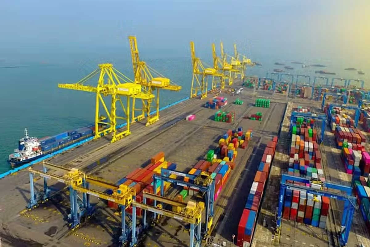
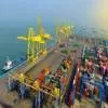
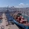
Kandla Deendayal Port Handles 150 MT in FY25

The Kandla Deendayal Port Authority (KDPA) has achieved its goal of handling 150 MnT of cargo in the financial year 2024–25, marking a key operational milestone. The update was confirmed by Chairperson Sushil Kumar Singh. The final figure stood at 150.16 MnT , and Singh credited the achievement to the collaborative involvement of stakeholders, including exporters, importers, shipping and customs agents. KDPA collected suggestions from port users and swiftly implemented changes to boost productivity and efficiency, addressing operational bottlenecks within existing constraints. Singh empha..

Next Story
Infrastructure Transport

Square Port Shipyard, Damen Partner to Boost Shipbuilding in India

Square Port Shipyard, a subsidiary of Hazoor Multi Projects Limited (HMPL), has signed an agreement with Damen Technical Cooperation BV to develop its shipyard in Dabhol (Ratnagiri), Maharashtra. The partnership aims to enhance the shipyard’s capabilities to design, build, repair, and maintain ships for both domestic and international clients. Damen Technical Cooperation BV is a part of the Netherlands-based Damen Shipyards Group NV, known globally for its shipbuilding expertise and advanced maritime solutions. Company officials described the tie-up as a significant milestone towards trans..

Advertisement

Advertisement

Subscribe to Our Newsletter

Get daily newsletters around different themes from Construction world.

STAY CONNECTED

Advertisement

Advertisement

Advertisement

Advertisement

Talk to us?