KDA to use DGNSS to demarcate its properties
Real Estate

KDA to use DGNSS to demarcate its properties

Kanpur Development Authority (KDA) will demarcate its properties using the Differential Global Navigation Satellite System. Following a presentation by its developer, KDA vice-chairman Arvind Singh directed that this digital technology be used first in the New Kanpur City being developed by the Authority between Mainavati Road and Kalyanpur-Bithoor Road.

He claims that this technique can be used to demarcate properties in remote areas. This allows for the simple geotagging of any land parcel. We can also create a digital map of the authority's properties using this technique, he added. According to SBA Rai, public relations officer, measuring properties in the past required a lot of manpower and time, and there was also the possibility of ankle error (angular error) or human error. However, using DGNSS technology, lands could be measured by a single person with minimal error, according to Rai.

Using this technology in the open area, where demarcation of land located in a 5 km area can be done sitting in one place, while in the occupied area, land located in a 03-3.5 km area can be marked.

“If we connect this technology through GSM or the internet, we can demarcate the land located in a 30-35 km area,” he added. SDM Sadar, his team, secretary KDA, all executive engineers, special officer (Land bank), tehsildar and amins were present during the presentation.

See also:
Maharashtra to finish mapping of rural land with drones by March-end
MP to carry out satellite survey for mega investment region


Kanpur Development Authority (KDA) will demarcate its properties using the Differential Global Navigation Satellite System. Following a presentation by its developer, KDA vice-chairman Arvind Singh directed that this digital technology be used first in the New Kanpur City being developed by the Authority between Mainavati Road and Kalyanpur-Bithoor Road. He claims that this technique can be used to demarcate properties in remote areas. This allows for the simple geotagging of any land parcel. We can also create a digital map of the authority's properties using this technique, he added. According to SBA Rai, public relations officer, measuring properties in the past required a lot of manpower and time, and there was also the possibility of ankle error (angular error) or human error. However, using DGNSS technology, lands could be measured by a single person with minimal error, according to Rai. Using this technology in the open area, where demarcation of land located in a 5 km area can be done sitting in one place, while in the occupied area, land located in a 03-3.5 km area can be marked. “If we connect this technology through GSM or the internet, we can demarcate the land located in a 30-35 km area,” he added. SDM Sadar, his team, secretary KDA, all executive engineers, special officer (Land bank), tehsildar and amins were present during the presentation. See also: Maharashtra to finish mapping of rural land with drones by March-end MP to carry out satellite survey for mega investment region

Next Story
Equipment

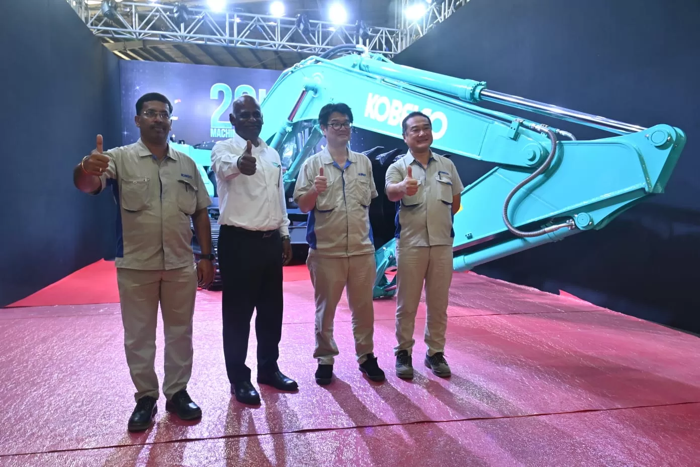
Kobelco CE India Marks Milestone with 20,000th Excavator

Kobelco Construction Equipment India (KCEI), a subsidiary of Japan-based Kobelco Construction Machinery Co., has reached a significant production milestone by rolling out its 20,000th excavator at its manufacturing plant in Sri City, Andhra Pradesh. This facility serves both domestic and international markets, reinforcing India’s role as a key production center for Kobelco.Takemichi Hirakawa, Managing Director & CEO, Kobelco Construction Equipment India, said, ""Reaching the 20,000th excavator production milestone reflects our commitment to delivering high-quality construction equipment...

Next Story
Infrastructure Transport

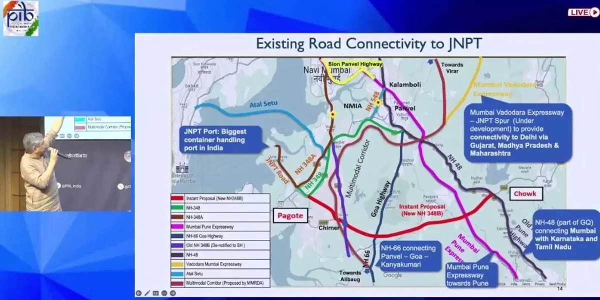
Cabinet Approves Highway from JNPA to Chowk in Maharashtra

The Cabinet Committee on Economic Affairs, chaired by Prime Minister Narendra Modi, has approved the construction of a 6-lane access-controlled Greenfield High-Speed National Highway from JNPA Port (Pagote) to Chowk in Maharashtra. The 29.219 km project will be developed on a Build, Operate, and Transfer (BOT) toll model at an estimated cost of Rs 45 billion. As part of the PM Gati Shakti National Master Plan, the project aims to enhance road connectivity to major ports, addressing increasing container traffic at JNPA and the upcoming Navi Mumbai International Airport. Currently, heavy co..

Next Story
Infrastructure Urban

Effective Implementation of MGNREGA in the Last Decade

The Mahatma Gandhi National Rural Employment Guarantee Act (MGNREGA), enacted in 2005, aims to enhance livelihood security in rural areas by guaranteeing at least 100 days of wage employment per year to willing adult members of rural households performing unskilled manual labour. Over the years, the government has significantly increased budget allocations for the scheme. From Rs 113 billion in 2006-07, the allocation rose to Rs 330 billion in 2013-14 and reached a record Rs 860 billion in 2024-25. During the COVID-19 pandemic in 2020-21, the government spent Rs 1,110 billion under MGNREG..

Advertisement

Advertisement

Subscribe to Our Newsletter

Get daily newsletters around different themes from Construction world.

STAY CONNECTED

Advertisement

Advertisement

Advertisement

Advertisement

Talk to us?